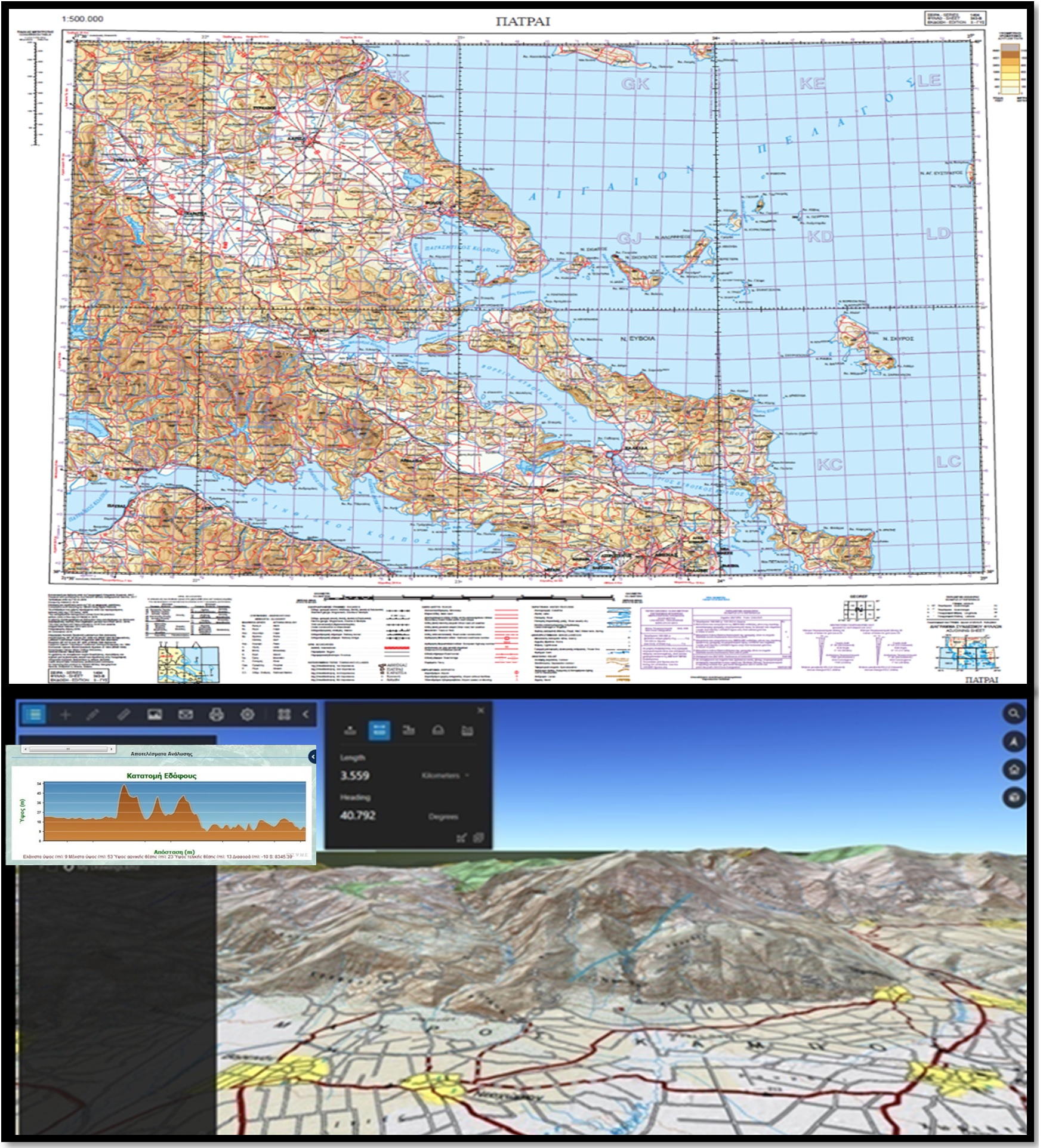
The mapping work of the modern Greek history commences with the establishment of the Geodetic Mission in 1889, which later (1895) evolved into the Army Mapping Service, until it took the form of the current Army Geographical Service in 1926. Terrain impression, drafting of diagrams and maps, as well as aerial photography of the Greek territory constitute a synonym of the Geographical Corps.
The foundation and maintenance of the geodetic infrastructure of our Country is mainly attributed to the Army Geographical Service. Every infrastructure work was based on maps, topographic diagrams or geodetic data of the Army Geographical Service for decades.
Furthermore, the Geographical Corps provides for any type of bookbinding and printing work required by HMoND, HNDGS and HAGS. Furthermore, it secures the real-estate of the National Defence Fund through cadastral works.
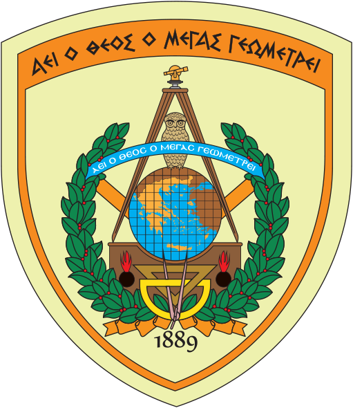
The Geographical Corps emblem
The emblem of the Geographical Corps consists of a representation and a maxim.
The maxim “ΑΕΙ Ο ΘΕΟΣ Ο ΜΕΓΑΣ ΓΕΩΜΕΤΡΕΙ” (the great God always applies geometry) is a famous phrase by Plato which indicates the significance of mapping for humans and the number of letters of every word corresponds to the digits of the mathematical constant π (pi=3,14159…).
The representation along with the maxim include the following elements along with their symbolism:
Theodolite, triangle, protractor and a pair of compasses: Basic elements of measurement
Owl: Symbol of knowledge
Greece on a geographical globe: The mapping jurisdiction of the Service
Two branches of laurel: The struggles of the Army Geographical Service for the Homeland and the Nation, as well as the fallen of the Service throughout the combat levels fought by the Hellenic Army.
The year 1889: Reminiscent of the year that the Army Geographical Service was established.
Our Mission
The mission of the Geographical Corps is the provision of the geospatial support of operations, impressing every inch of the Greek land and securing the territorial impression of our homeland. A basic ingredient for successful execution of the mission is the conduct of scientific observations on our Country’s geodetic networks and the mapping production of printed products, digital applications and the constant research on new technologies.
Characteristics
The Geographical Corps is mainly characterised by:
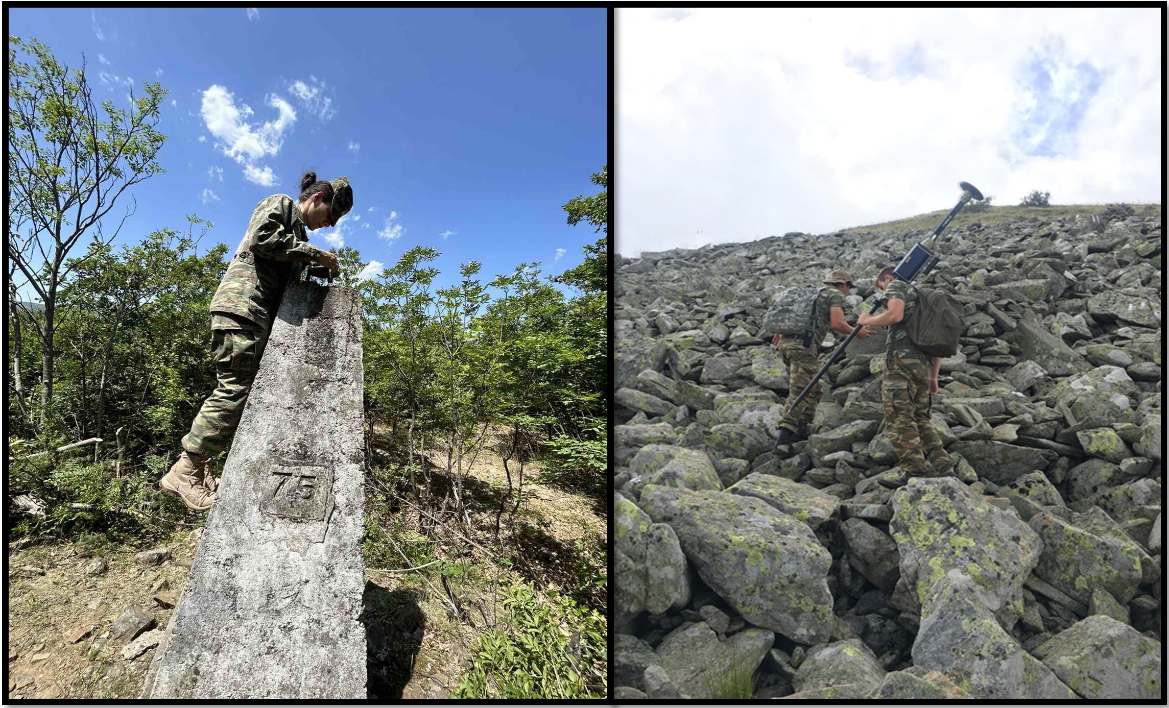
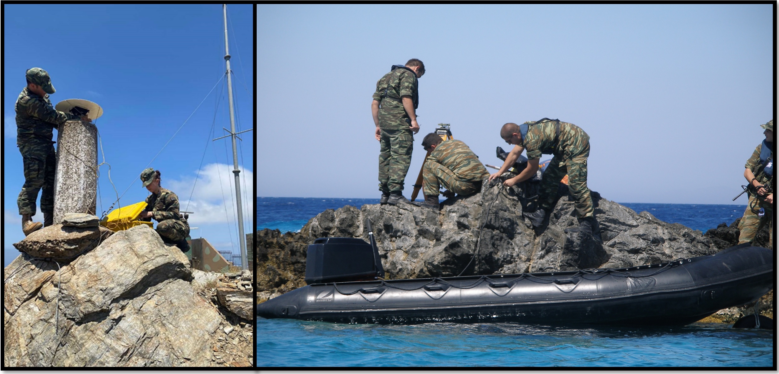
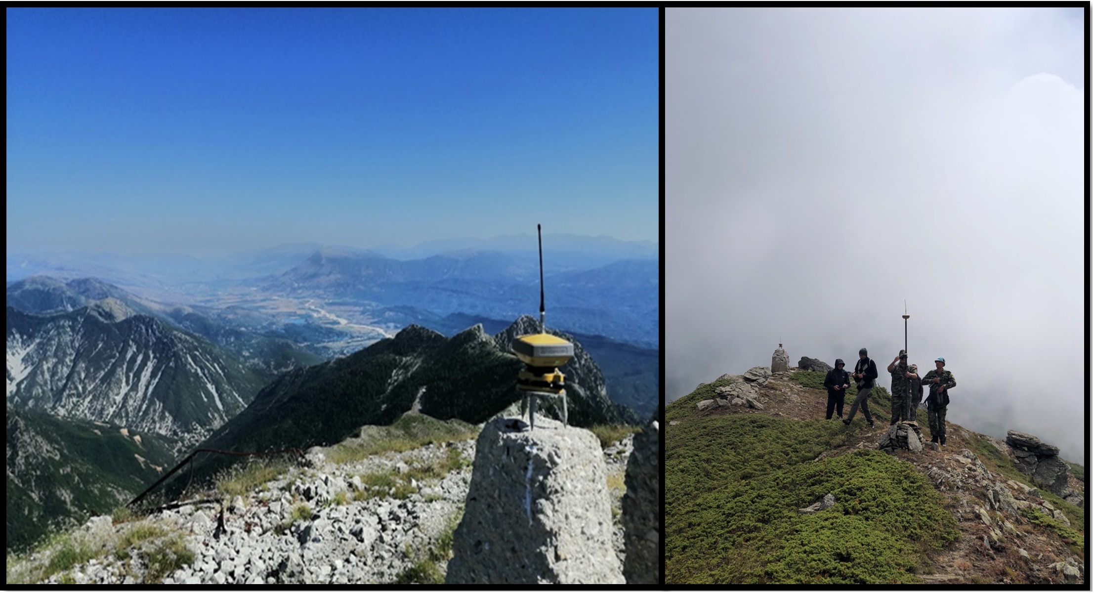
Measurement Works in the field
Aerial photography of the whole Greek territory
Observance of border agreements
Geospatial support to the Armed Forces and contribution to foreign policy
Cadastral registration of the National Defence Fund Real-Estate
Numerous printing and bookbinding works
Servicing of the country’s technicians community and the whole of society